"Xuanlannuo" will once again be enhanced into a super typhoon with strong storms in Zhejiang and Shanghai.
Cctv newsWith the 11th typhoon "Xuanlannuo" approaching the coastal areas of East China this year, there were obvious rainfalls in parts of Zhejiang, Shandong Peninsula and Taiwan Province yesterday. Among them, heavy rains occurred in Ningbo, Zhejiang, Shaoxing and parts of central and northern Taiwan Province Island. The Central Meteorological Observatory predicts that "Xuanlannuo" will once again strengthen into a super typhoon level during the daytime today, and gradually tend to the waters near Zhejiang. The next 36 hours will be the main impact period of "Xuanlannuo" on China’s land and offshore.
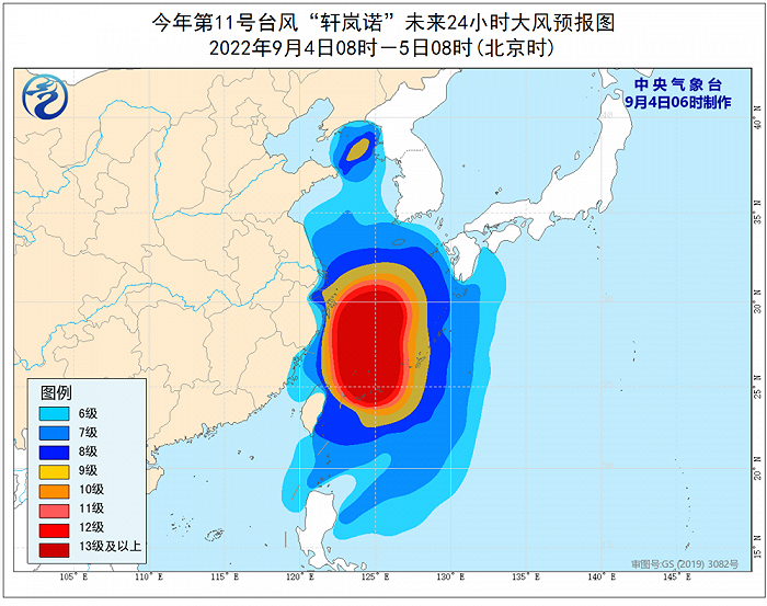
At 8 o’clock this morning, the center of "Xuanlannuo" (strong typhoon level) was located on the sea about 470 kilometers east-south of Zhujiajian Island Island, Zhejiang Province. It is estimated that it will move to the north-west direction at a speed of 20 kilometers per hour, and its intensity will gradually increase. Today, it will once again increase to a super typhoon level (level 16, 52-55 m/s) during the day, and gradually approach the offshore of northeast Zhejiang. From the night of the 4th to the morning of the 5th, it will turn to the northeast near the offshore of Zhejiang, with the nearest distance of about 150~170 kilometers from the coastline of Zhejiang, and then gradually move towards the south of the Korean Peninsula to the area of the Korean Strait.
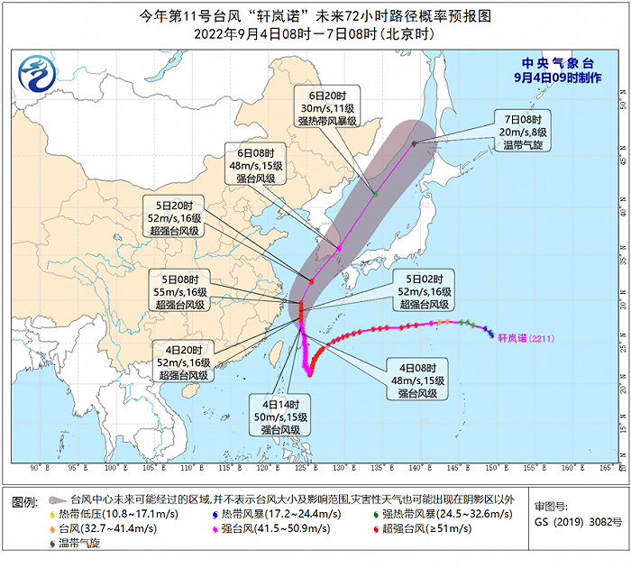
Affected by it, there will be a great wind and rain impact in the coastal areas of East China. It is expected that in the next three days (4 to 6),There will be 9~12 winds in the east of Taiwan Province, the East China Sea, the waters near Diaoyu Island, the Yangtze River estuary, Hangzhou Bay, the coastal areas of Zhejiang, Shanghai and southeastern Jiangsu.There are 13~16 winds near the sea where Xuanlannuo Center passes, and the gust can reach more than 17.
In terms of rainfall, today (4th), there were heavy rains in Taiwan Province Island, northeastern Zhejiang, Shanghai and other places, and local heavy rains.The Central Meteorological Observatory continued to issue a yellow typhoon warning this morning..
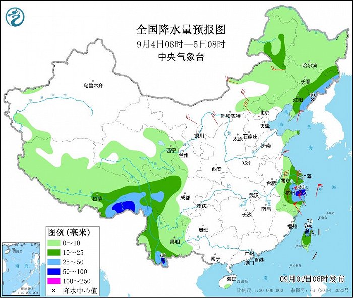
On the 5th, Typhoon Xuanlannuo turned to the northeast, which weakened the impact on the precipitation in the eastern coastal areas. Because there is enough water vapor on the east side of it, there will be moderate to heavy rain and local heavy rain in parts of northeastern Inner Mongolia, Heilongjiang and eastern Jilin.
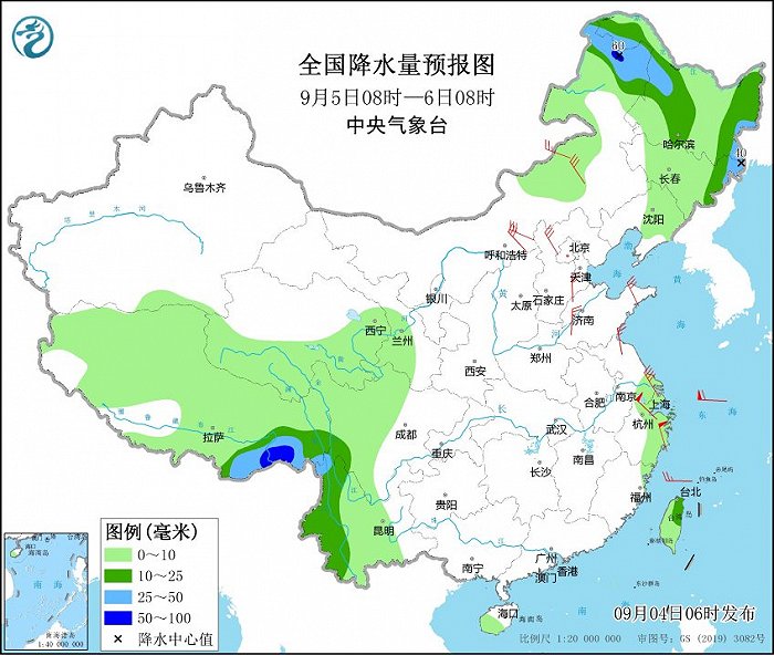
Affected by the plateau trough, it will be rainy in the Qinghai-Tibet Plateau and Southwest China in the next three days, with moderate to heavy rain and local heavy rain in western Sichuan, western Yunnan and southeastern Xizang; Pay attention to the short-term heavy precipitation in Yunnan.
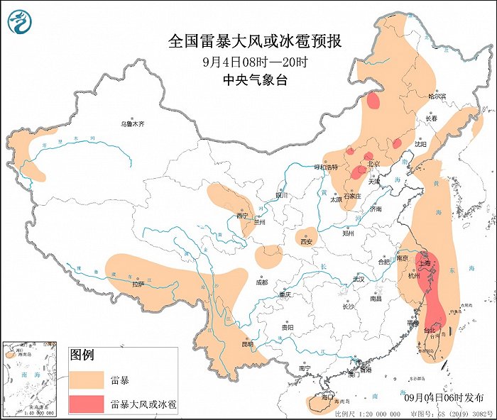
In addition, from this afternoon to night, there will be strong convective weather in the north-central part of North China. Among them, there are short-term heavy precipitation weather in parts of north-central Hebei and Beijing, with an hourly rainfall of 20~40 mm and a local area of more than 60 mm; There will be thunderstorms, strong winds or hail weather in central and northern Hebei and southwestern Beijing.
Meteorologists warned that due to the continuous precipitation, the risk of local geological disasters in northeastern Zhejiang and southeastern Xizang is high. Do not go to dangerous areas, pay attention to the latest official forecast and early warning information, and take preventive measures in advance.